Several applications that demonstrate the usefulness of the HaptiMap toolkit has been developed. This page lists the ones available/maintained after the end of the project. If you have developed a new application that uses the HaptiMap toolkit - please contact us to advertise it on this page.
JOINED is a fully accessible geo-social community app that helps users to find places and to meet people. Locations are easily stored, shared and recalled. Users can chat free of charge and have full control over their own position data.
Link iTunes: https://itunes.apple.com/de/app/joined/id478286344?mt=8
Link Google Play:
https://play.google.com/store/apps/details?id=de.geomobile.joined&hl=de

Joined screenshots
The PocketNavigator by OFFIS is a Google Maps-like navigation application targeting sighted cyclists and pedestrians. By providing non-visual navigation cues it aims at reducing the users’ distraction but also may become accessible for people who are visually impaired (according to the design 4 all principle). http://www.pocketnavigator.org/

Screenshot PocketNavigator
The Event Guide – Juicy Beats by GEOMOBILE is a map-based festival guide for the Juicy Beats open-air festival. It illustrates an accessible overview over the festival area and comes with an often requested feature: an (accessible) friend finder.
Link iTunes: https://itunes.apple.com/gb/app/juicy-beats-guide/id322527306?mt=8
Link Google Play: https://play.google.com/store/apps/details?id=de.geomobile.juicybeats

JuicyBeats screenshots
SOESTER BUSGUIDE. This accessible app helps users to plan their journey from their current location to any other train station, a specific address or point of interest. Users are fully informed before and during their journey by providing comprehensive timetables, nearest stops, real-time information on arrival times and more useful information.
iTunes Link: https://itunes.apple.com/de/app/soester-busguide/id530482296?mt=8

Screenshots Soester Busguide
TANDEM Tour Guide by GEOMOBILE & SOEST is a system to support tandem cycling tours with people who are blind and sighted teaming up. Only the person who is blind gets access to the navigation instructions and information about the POIs along the route.
Link Google Play: https://play.google.com/store/apps/details?id=de.geomobile.g4b

Screenshots TANDEM Tour Guide
MEISTERKORSO
Meisterkorso was an accessible event guide app for the German football league champion’s parade in May 2012 in Dortmund featuring the HaptiMap bearing aid for locating the current position of parade vehicles and using the LocPP-API for finding friends.
Link iTunes: https://itunes.apple.com/de/app/meisterkorso/id524992047?mt=8
Link Google Play: https://play.google.com/store/apps/details?id=de.geomobile.meisterbus

Screenshot Meisterkorso
The Time Machine by ULUND is a location-based tour guide allowing you to embark on a time travel through the past of Lund. It aims at being accessible for blind and elderly users. Webpage: http://tidsmaskinen.certec.lth.se/
Contacts:
This email address is being protected from spambots. You need JavaScript enabled to view it.
This email address is being protected from spambots. You need JavaScript enabled to view it.

Screenshots The Time machine
Cityguide Soest. The accessible app helps blind, visually impaired and sighted users to navigate in the city of Soest as a pedestrian on secure ways. They are able to find all infrastructure, doors, buildings, bus stations and all you need in the normal live with integrated bearing module and a turn by turn navigation. The people will be leaded in a small corridor based on high accuracy maps with integrated obstacles, traffic signs and more. It is also a tourism application with audio guides specially for blind people.
Contact: This email address is being protected from spambots. You need JavaScript enabled to view it.

Screenshots CityGuide Soest
The Virtual Excavator by GLASGOW allows exploring uncureated archaeological sites. Although the interaction is visual, all content is delivered as audio allowing users who are blind to receive the same information as sighted users would.
Contact: This email address is being protected from spambots. You need JavaScript enabled to view it.

Screenshots Virtual Excavator
The Virtual Observer by OFFIS is a set of tools for developers to allow the unsupervised evaluation of location-based services. It uses context-sensing techniques to recognize relevant “events”, e.g. navigation errors, disorientation events or phases of distracting interaction on the move.
Contact: This email address is being protected from spambots. You need JavaScript enabled to view it.

Virtual Observer
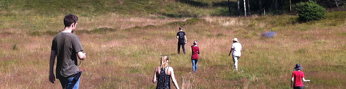
The Terrain Navigator by FGI is a hiking companion that supports planning and carrying out hikes in a national park. It is targeted at all kind of user groups: sighted, elderly, and visually impaired.
Contact: This email address is being protected from spambots. You need JavaScript enabled to view it.

Screenshots, two different zoom levels in the Terrain Navigator
The TrainerTools by TECNALIA & ONCE is a set of tools for mobility trainers to create user profiles and routes that are tailored to individual people with visual impairments. It provides an adaptable user interface that adapts to the context, the needs of the user who is blind, and the route affordances. The NavEscort by TECNALIA & ONCE is coupled to the TrainerTools. It’s aim is to actually guide a person who is blind. It takes a route and a user profile – both created with the help of the TrainerTools – and provide a highly accessible routing experience for people who are blind.
Contact:
This email address is being protected from spambots. You need JavaScript enabled to view it.
This email address is being protected from spambots. You need JavaScript enabled to view it.

Trainer tools and NavEscort
The Toolkit Samples by QUB is a set of code samples that demonstrate individual toolkit functionality. It illustrates the toolkit’s modularity, the cross-platform development and access to geographic data.
Contact: This email address is being protected from spambots. You need JavaScript enabled to view it.
The Desktop Hiking Planner by QUB is a desktop application for planning a hike in a national park. With the help of haptic and auditory feedback users that are blind can explore the Skrylle national park with a particular focus on obtaining height information.
Contact: This email address is being protected from spambots. You need JavaScript enabled to view it.

Screenshot Desktop Hiking Planner